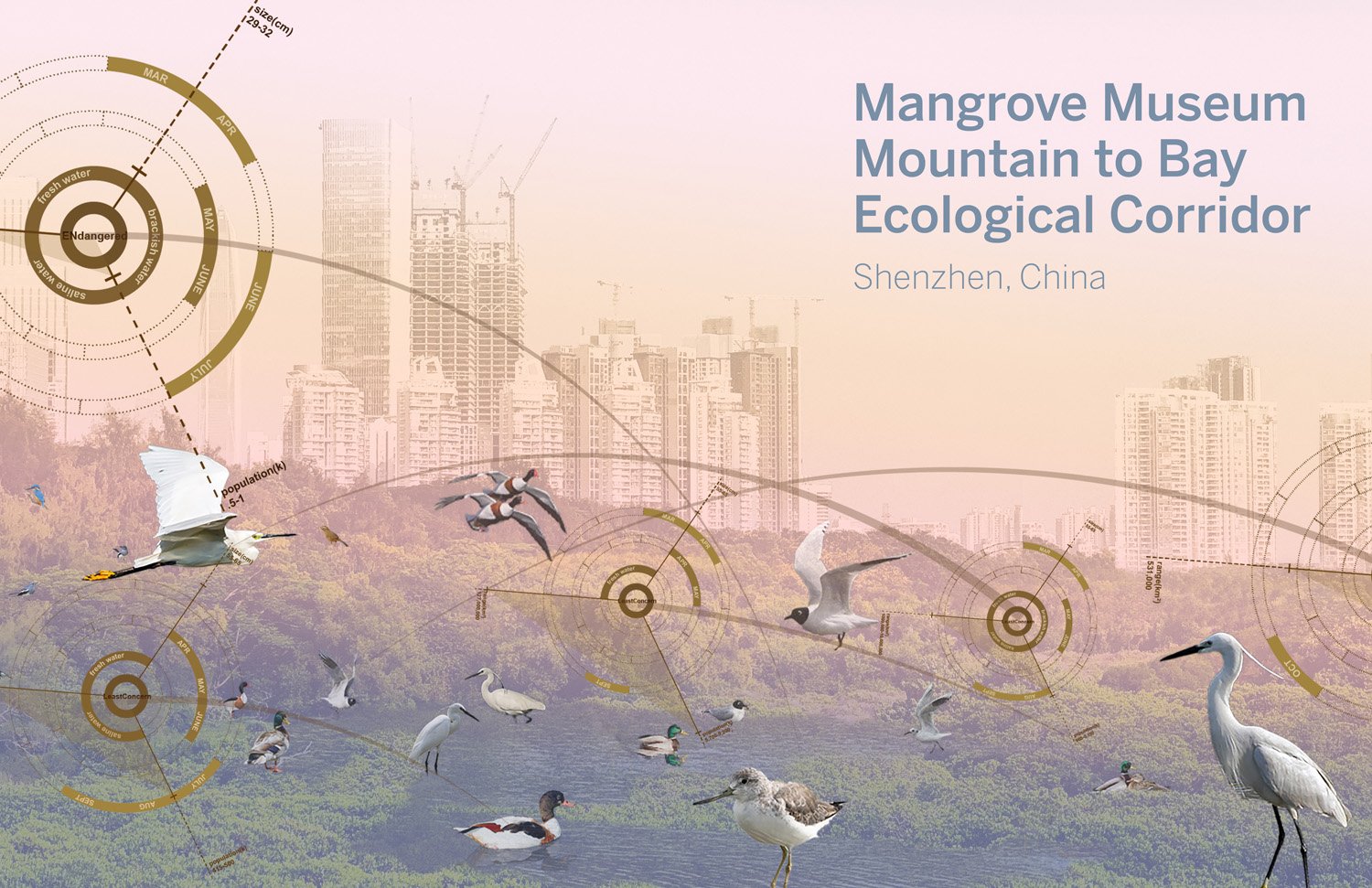
The Mangrove Museum Mountain to Bay Ecological Corridor
Shenzhen, China


The metropolis of Shenzhen, located on the northern edge of Shenzhen Bay on the eastern side of the Pearl River estuary, is an essential cultural and economic link between Hong Kong and Mainland China. Since 1980, Shenzhen has been one of the fastest-growing cities in the world. In its former, more natural state, Shenzhen was defined by a contiguous topographic and ecological gradient rising from the resource-rich Pearl River to the mountainous region along the city's northern boundary. The surface continuity from low to high as part of the larger regional morphology resulted in a series of robust transitional ecosystems moving from Mountain to Bay: a multi-layered, overlapping, resilient, and diverse ecological network.
In response to rapid urbanization, 20th-century planning efforts primarily addressed transportation needs. This focus led to the development of thoroughfares, highways, and rail lines that connected the city's neighborhoods. These roadways facilitated urban connectivity but also fragmented the once vibrant and interconnected ecology. As a result, the remaining ecological patches have become disconnected and isolated, struggling to survive the harmful aspects of urbanization.
This framework plan is a pursuit to mitigate the negative impacts of past urbanization strategies and does so by establishing an environmentally principled overlay that seeks to reunify ecological systems.
Client: Guangdong Neilingding Futian National Nature Reserve Management Bureau, Planning and, Natural Resource Bureau of Shenzhen Municipality, Urban Management Bureau of Shenzhen Municipality, Shenzhen Municipal People's Government
Collaborators: Adele Santos, Santos Prescott Associate | Rafi Segal, Associate Professor of Architecture and Urbanism, MIT | Huang Weidong, Executive VP, Technical Director, Urban Planning & Design Institute of Shenzhen
Status: Plan completed 2021
Awards: 2025 WLA Awards Honourable Mention, 2023 BSLA Merit Award, 2022 Hong Kong Institute of Urban Design, The Greater Bay Area Urban Design Awards Grand Award, Plan/Concept
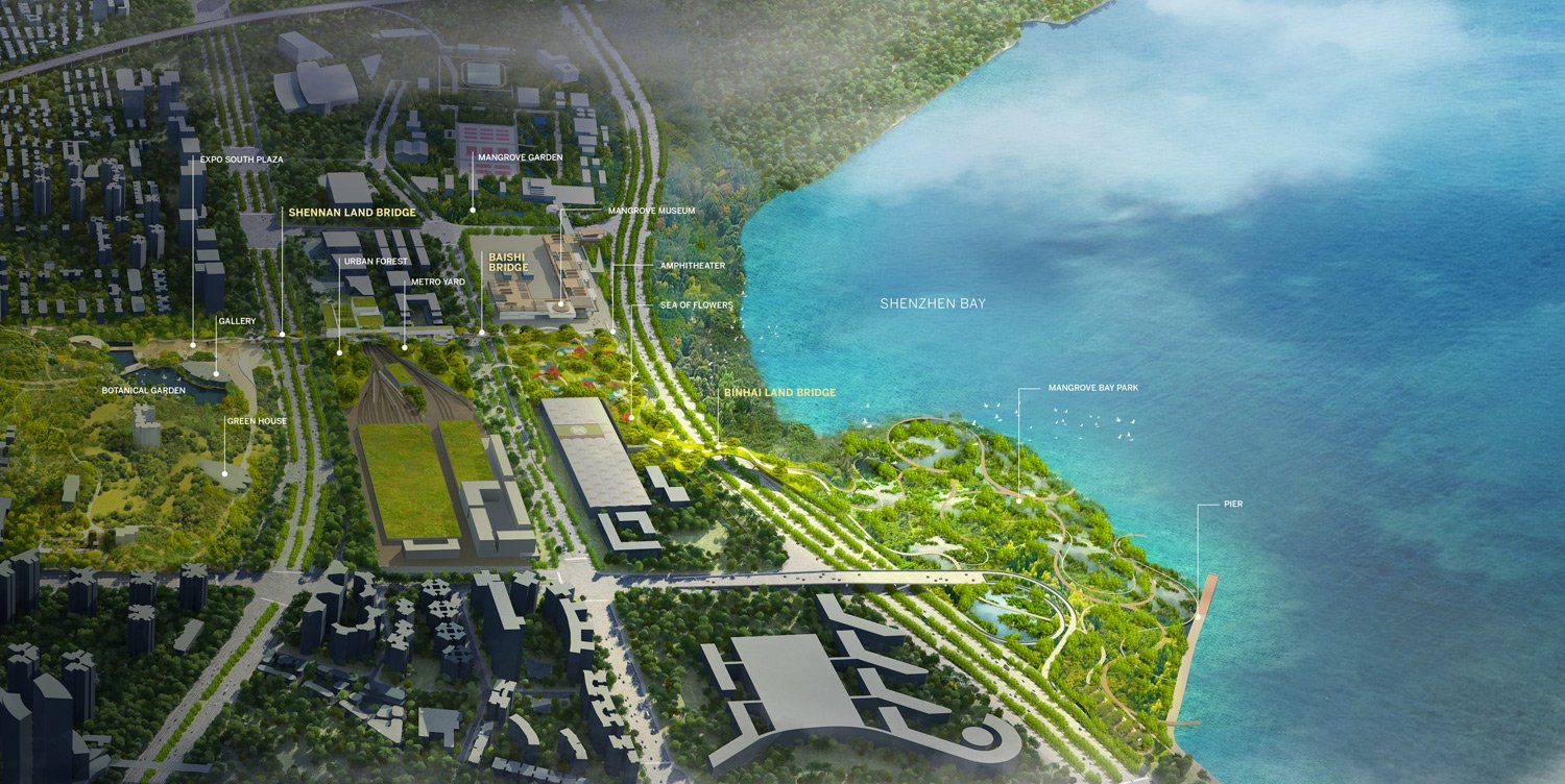
Therefore, the primary goal of the project is twofold: firstly, to identify the various remnant eco-zones that exist between Antou Mountain and Shenzhen Bay, and secondly, to develop a precise methodology for overlapping and combining these disparate zones into a cohesive, dynamic whole. Ecology plays a central role, guiding the flow of movement from the mountains, through the urban landscape, and down to the Bay.
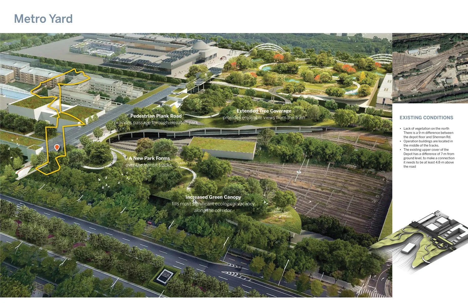
The first zone, Mangrove Park, deals with eliminating invasive species and re-introducing mangroves to restore the ecosystems damaged by industrialization and to create an ecological storm buffer. The second zone is the Sea of Flowers, a landscape built upon a platform above a massive bus station and repair facility, to create hills and valleys for local flora and fauna to emerge. The Metro Yard is also a new landscape built on a platform that extends over an existing railyard that will develop as an urban forest with nesting walls for migrating birds. The fourth zone is the Expo Park, a restored landscape showcasing traditional Chinese gardens. The corridor then arrives at the mountain foothills, the planned site of a new Cultural Center. The final land bridge extends from the foothills up to Antuo Mountain Park.
Goals
Following the recommendations developed by the work on patch dynamics of acclaimed landscape ecologist Richard Forman, the design team created linkages between each zone to connect and enhance continuity within landscape transition zones. These connectors were established to provide elongated ecological experiences and greater biodiversity. Adjacent zones overlap so that proper thickening of local, adaptive ecologies over time ensure a more sturdy and resilient transition across the entire transect. The transitional zones between ecosystems, interpreted as vegetated, earthen bridges spanning the highways, foster more beneficial physical connections enabling the passage of small mammals and people alike. These connections contribute to the tree canopy's continuity, further enhancing bird habitat for local and migratory birds.
Site Plan
click below for slide show of additional images


click below for slide show of additional images